Table of Contents
- 1. More Than Ornament: The Hydraulic Reality of the Moats
- 2. The Sungi-Penet Interfluvial Divide: Intake Engineering
- 3. Multi-Chamber Sedimentation: Pre-Modern Water Purification
- 4. Downstream Subak Flow: Gravity-Fed Agricultural Networks
- 5. Passive Microclimatic Cooling: Thermal Buffer for Shrines
- 6. Verified Sources & Scholarly References
Guidebooks unfailingly describe the wide waterways encircling Pura Taman Ayun as "picturesque ornamental moats" built for royal leisure. This aesthetic reductionism misses the entire civil engineering purpose of the site. In the seventeenth century, Balinese hydraulic masters did not expend tens of thousands of man-hours excavating deep stone-lined canals merely to reflect lotus blossoms. Taman Ayun was engineered as a high-performance flow-through water reservoir and hydraulic regulator, serving as the master valve distributing fresh water across thousands of hectares of downstream Subak rice terraces throughout southern Badung.
When organizing agrarian and architectural study trips in Badung Regency, calculate your required travel contributions via the Bali Tourist Levy & Entry Requirements Calculator, supporting ongoing irrigation monument preservation.
1. More Than Ornament: The Hydraulic Reality of the Moats
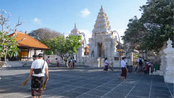
Pura Taman Ayun sits upon an artificial island roughly 100 meters wide by 250 meters long. It is completely surrounded by two distinct concentric water systems: an expansive outer moat measuring up to thirty meters in width, and an inner moat separating the intermediate assembly courtyard (Jaba Tengah) from the consecrated inner sanctum (Jeroan).
Unlike European castle moats that held stagnant, muddy water designed strictly for military siege defense, Taman Ayun’s moats are dynamic, living water conduits. Water enters continuously from upstream canals, circulates through a sequence of calibrated hydraulic channels, and exits through sluice gates to irrigate fertile rice paddies to the south.
The engineering precision is breathtaking. Ancient builders graded the moat bed with an imperceptible 1:500 slope, ensuring that water flows at a gentle velocity sufficient to prevent stagnation and mosquito larvae development while avoiding turbulent bank scouring that could erode the stone revetments.
2. The Sungi-Penet Interfluvial Divide: Intake Engineering
Hydrologists from Udayana University mapping the Mengwi watershed discovered that Taman Ayun occupies an engineered saddle between two of Bali’s major river systems: the Tukad Sungi to the west and the Tukad Penet to the east.
| Hydraulic Zone | Engineering Structure | Hydrological Function |
|---|---|---|
| Intake Weir (Hulu) | Upstream gravity feeder canal from Tukad Penet | Continuous freshwater intake during both wet and dry seasons. |
| Outer Retention Moat | Wide stone-lined peripheral basin (30m wide) | Primary water reservoir (holding over 45,000 m³ of emergency agricultural water). |
| Inner Moat System | Narrow perimeter moat enclosing inner Jeroan | Thermal cooling barrier; fine sediment clarification. |
| Discharge Sluices (Hilir) | Four stone gravity overflow weirs (Tetuad) | Controlled water release feeding 14 downstream Subak irrigation federations. |
By capturing river flow at an elevated upstream contour, the temple’s reservoir holds water at an elevation roughly five meters higher than the surrounding southern farmland, enabling 100% gravity-fed distribution without pumps.
3. Multi-Chamber Sedimentation: Pre-Modern Water Purification
One of the brilliant features of Taman Ayun’s hydraulic design is its function as a natural settling basin (Sediment Trap). Volcanic river runoff in Bali carries heavy silt loads during monsoon cloudbursts. If this silt is allowed into narrow irrigation ditches, it clogs wooden Temuku proportioning weirs.
Nature's Silt Trap
As fast-flowing river water enters the wide expanse of the outer moat, its linear flow velocity drops dramatically. Suspended silt, sand, and heavy clay particles naturally settle to the stone floor of the moat, allowing clean, clarified, oxygen-rich surface water to spill over the downstream discharge weirs into agricultural canals. Dense beds of pink water lilies (Nelumbo nucifera) and water hyacinths absorb excess agricultural nitrates, naturally polishing the water before it reaches the rice paddies.
Sediment cleanout is integrated directly into the ceremonial calendar. Every five years, following major agricultural cycles, the Subak communities assemble for communal desiltation (Ngikis Kolam). The rich volcanic silt dredged from the moat beds is carried back to adjacent rice terraces as organic mineral-rich fertilizer, creating a completely sustainable circular nutrient economy.
4. Downstream Subak Flow: Gravity-Fed Agricultural Networks
Taman Ayun is officially classified as a Pura Masceti—a regional headwater distribution temple. Fourteen autonomous Subak cooperatives in the Mengwi, Kapal, and Abiansemal districts receive their water directly from the temple’s sluice gates.
Every thirty-five days, the elected farmer-leaders (Pekaseh) of these fourteen Subaks assemble in the open Wantilan pavilion in the temple’s outer court. In this sacred setting, farmers negotiate water release volumes, resolve border disputes, and plan coordinated planting rotations. The temple acts as both the physical water faucet and the judicial courthouse of the agrarian landscape.
This decentralized negotiation model prevents upstream farmers from hoarding water during the dry season. Because water is conceptualized as the divine gift of Dewi Danu, diverting more than one's allotted share is treated not merely as a civil infraction, but as a severe spiritual sin (Dosa) requiring ritual atonement. This sacred sanction ensures equitable water flow down to the lowest coastal paddies.
5. Passive Microclimatic Cooling: Thermal Buffer for Shrines
Beyond its agricultural function, the moated design serves an essential architectural preservation purpose. Central Bali experiences high tropical temperatures with intense thermal radiation during the dry season. Large wooden shrines roofed with organic sugar-palm fiber (Ijuk) are highly vulnerable to fire and timber cracking caused by dry heat.
The vast surface area of open water continuously evaporates into the air, creating an enduring cool microclimate. Ambient temperatures inside the inner sanctum of Taman Ayun remain 2°C to 4°C cooler than the surrounding urban streets, while relative humidity is stabilized, protecting the centuries-old teak and ijuk structures from desiccation and insect infestations.
Furthermore, the continuous movement of water through the canals creates an acoustic buffer. The gentle, bubbling sound of water cascading over weir gates drowns out ambient traffic noise from the nearby town of Mengwi, allowing priests and visitors to experience a peaceful sonic environment essential for meditation and ritual focus.
6. Verified Sources & Scholarly References
- Lansing, J. Stephen: Priests and Programmers: Technologies of Power in the Engineered Landscape of Bali (Princeton University Press).
- Balai Wilayah Sungai (BWS) Bali-Penida: Kajian Konservasi Sumber Daya Air dan Jaringan Irigasi Subak Pura Taman Ayun (Denpasar, 2021).
- UNESCO World Heritage Centre: Cultural Landscape of Bali Province: Subak System Nomination Dossier (2012).
- Fakultas Teknik Pertanian Universitas Udayana: Analisis Hidrolika Kolam Retensi Pura Taman Ayun Mengwi.